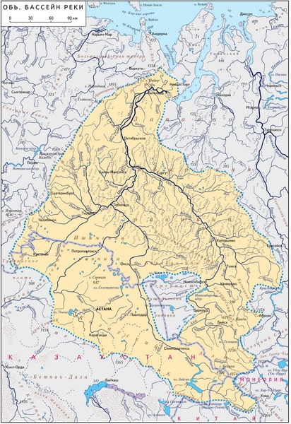
Map of the Ob River Basin

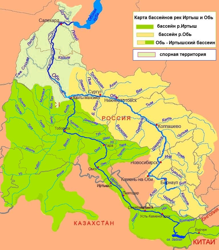
Map of the Ob and Irtysh river basins
The Ob is one of the largest rivers in the world. It originates at the confluence of the Biya and the Katun. The length of the Ob is 3650 km, the area of its drainage basin is 2,990,000 km². Water flow 287 km from the mouth (near Salekhard) is 12,492 m³/s (which corresponds to an annual flow of 394 km3). At the mouth it forms the Gulf of Ob and flows into the Kara Sea.
The area of the Ob basin is 2 million 990 thousand km². According to this indicator, the river ranks first in Russia. The Ob is also the third most water-bearing river in Russia (after the Yenisei and Lena).

In the southern part of the Ob there is the Novosibirsk reservoir, formed by the dam of the Novosibirsk hydroelectric power station. The main tributary of the river is the Irtysh. The length from its source on the border of Mongolia and China to its confluence with the Ob on the left is 4248 km - it exceeds the Ob in length by 592 km.

The Ob is navigable along its entire length. At the same time, the following navigable areas are distinguished on the Ob and its tributaries:
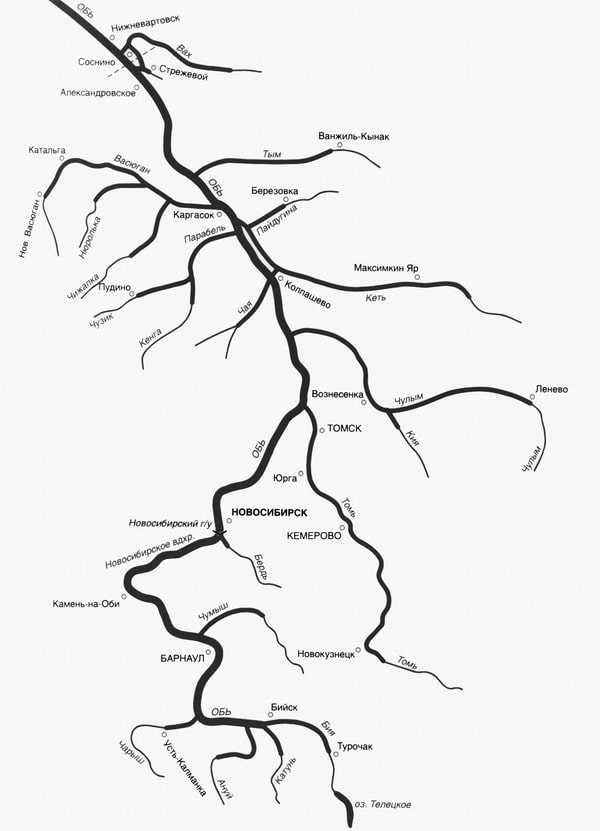
Barnaulsky - from the confluence of the Biya and Katun to Kamen-on-Obi, including the mouth areas of the Biya, Katun, Charysh and Lake Teletskoye. Guaranteed depths - 110-140 cm;
Novosibirsk Reservoir - from Kamen-on-Obi to the outport of the Novosibirsk Lock,
Novosibirsk - from the outport of the Novosibirsk lock, including the lock itself to the mouth of the Tom. Guaranteed depths - 210-240 cm,
Tomsky - from the mouth of the Tom to the Parabel channel and the section of the Tom from the mouth to Kemerovo. Guaranteed depths on the Ob and Tom to Tomsk are 210-240 cm,
Kolpashevsky - from the Parabel channel to the border of the Tomsk region and a section of 274 kilometers along the Ket River. Guaranteed depths on the Ob are 240-270 cm,
Ob-Irtyshsky - along the Irtysh from Omsk to the mouth of the Irtysh. Guaranteed depths on the Ob are 140–180 cm;
Surgutsky - from the border of the Tomsk region to the mouth of the Irtysh. Guaranteed depths on the Ob are 240–270 cm;
Khanty-Mansiysk from the mouth of the Irtysh to the mouth of Kazym. Guaranteed depths on the Ob are 270-300 cm;
Salekhardsky - from the mouth of Kazym to the Ob Bay. Guaranteed depths on the Ob are 270-300 cm.
The Gulf of Ob has a maritime navigation regime.
The main ports and marinas of the Ob-Irtysh basin: Biysk river port, Barnaul river port, Novosibirsk, Tomsk, Samus, Nizhnevartovsk, Surgut, Labytnangi, Pavlodar, Omsk, Tobolsk, Tyumen, Khanty-Mansiysk.
Currently, about 50 species and subspecies of fish live in the waters of the Ob and Ob Bay, half of which are of industrial value. The most valuable species: sturgeon, sterlet, nelma, muksun, broad whitefish, tugun, whitefish, peled. Fishing objects are mainly small ones - pike perch, pike, ide, burbot, bream, dace, roach, crucian carp, perch.