Bottom topography and depth of the Barents Sea
How the depths of the Barents Sea change in different areas of the sea, how the bottom topography in the sea changes and what kind of soils are in the Barents Sea.
Depth of the Barents Sea
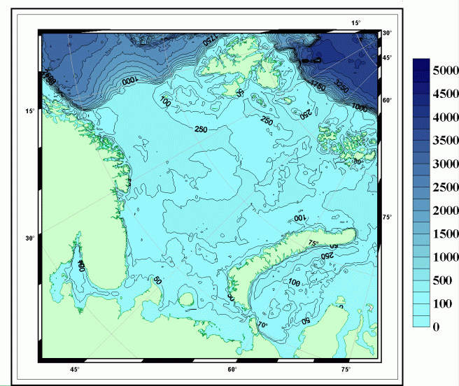
The Barents Sea is a typically continental sea, which lies entirely on the shelf of the Arctic Ocean, which within its boundaries is deeper than in other Arctic seas. In most of the Barents Sea, the depth is 300 - 400 m. The coastal shallows of the Barents Sea with depths of less than 50 m occupy a significant area only in the southeast and in its northwestern part.
Bottom topography of the Barents Sea
The bottom topography of the Barents Sea is characterized by strong dissection. At distances of tens of kilometers, depth differences are 50 - 100 m.
The bottom topography of the Barents Sea includes plains (Central Plateau), hills (Central, Persea, with a minimum depth of 63 m), depressions (Central with a maximum depth of 386 m) and trenches (Western Trench of the Barents Sea with a maximum depth of 600 m, Franz - Victoria - 430 m).
The depth of the southern part of the Barents Sea is less than 200 m and the bottom topography is flat.
The western part of the Barents Sea is the deepest. The maximum depth of the Barents Sea is also located here.
Bottom topography of the Barents Sea
Soils of the Barents Sea
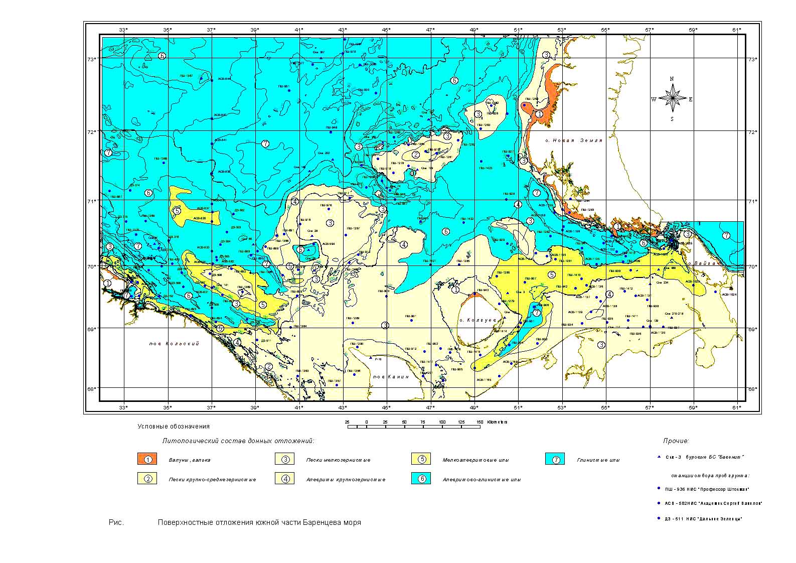
In addition to large structural forms of bottom relief in the Barents Sea, at depths less than 200 m, there are numerous small bottom irregularities, which is associated not only with the geological history of the sea, but also with the influence of hydrological elements. The distribution of soils in the sea is also related to this. Most of the bottom of the Barents Sea (northern half, Central Basin, Novaya Zemlya Trench) is covered with sandy silt. The coastal slopes and slopes of the Murmansk and Rybachya banks and the Central Upland are covered with silty sand. There is sand on the surface of the Medvezhenskaya and Spitsbergen banks.
The southeastern part of the sea is occupied by silt deposits, which is explained by the weak mobility of water in this area and the transport of fine material by rivers and ice. In the North Cape Trench there are erosion zones, accumulations of boulders and areas of rocky bottom caused by the intense North Cape Current.
Seabed sediments of the Barents Sea

Seabed sediments of the Barents Sea
